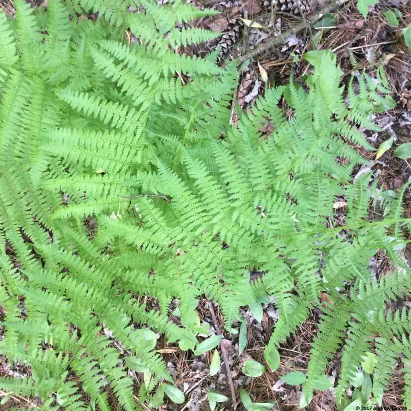
Thunderstorms bearing down, hatches are battened. Each dot represents a cloud to ground lightning strike, the ring the thunder ‘sound front’, all overlaid on radar returns. Image from lightningmaps.org.


Thunderstorms bearing down, hatches are battened. Each dot represents a cloud to ground lightning strike, the ring the thunder ‘sound front’, all overlaid on radar returns. Image from lightningmaps.org.
My desire to post has flagged this week.
Wednesday and Thursday were windy and unseasonably warm; the high both days as 31. Shades mostly drawn, windows open only an inch or two to keep the worst of the heat out, yet let some fresh air in – we won’t put the a/c in the window yet. Today’s high was 9 and the windows were closed to keep the warmth in.
This spring has definitely been an interesting one.
The calendar reports that spring began 17 days ago.
Winter begs to differ.


Today I posted my first observation to the CoCoRaHS database. This is a network of several thousand volunteers in the US and Canada who observe and report daily what precipitation fell. It’s also a site to report significant weather, such as hail, very heavy rain or snow, severe winds, and so forth.
I’ve informally collected weather data for years. Reporting through CoCoRaHS is a cool way to formalize and further systematize my hobby. It’s also a great way to share the data I collect, and make it available to others.

I left work the other day as a wicked thunderstorm rolled into the area and raced home, attempting to beat it.

I’m a weather geek and enjoy surfing various forecast services. My primary soures are Environment Canada, The Weather Network, and the US National Weather Service. Intellicast and the Weather Underground provide useful information. I ignore The Weather Channel – too much breathless hype for me. I review the available forecast packages then make an educated guess at what will happen.
Today we had some sun and it warmed up to about 4 degrees, which melted some of the snowpack. Tomorrow morning we have a chance at snow and/or freezing drizzle which will make for an interesting drive. Dropping Stella at the vet for some dental cleaning, she’s lost five pounds over several months and about 1 1/2 since her last visit a month ago. Her standard weight is about 35 or 36 so it’s concerning.
Tomorrow afternoon and evening we could see heavy rain, possibly an inch or more. That’s a lot of rain to fall on our ten inches or so of snow. We might get a rumble of thunder. Then a cold front sweeps through during Thursday night bringing colder temperatures and winds possibly gusting to 80 kilometers per hour (around 50 mph). May our and our neighbours’ trees stay where and as they are.
I’m not Panicky or Freaking Out, weather like this is a part of life and of living in this part of the world. It’s good to be knowledgeable and prepared.

I like to track weather and climate data. Though my instruments are non-precision they help me track daily high and low temperature, rainfall, and snowfall. I write the numbers on the calendar then transfer them to a spreadsheet, in which I keep the data in tabular and graphical form. It’s a cool way to see what happens during the month, year, and over the years since I have lived in Dresden. It’s also neat to compare against climate data collected here by Environment Canada during the years 1971-2000.
Here is the graph for January through yesterday morning. The red line is the high, the roughly corresponding line is the low, green = rain and lighted blue = snow. Up and down the temperatures have gone. Despite that big dip our average low of -6 is three degrees warmer than the historic average of -9. Another big dip looms in the next few days, which should bring that average low more in line with the historic data. The green spike is a day of rain, and we have already exceeded the average snowfall by a comfortable margin.

It seem that there is the potential for us to experience a ‘major icing event’ to use Environment Canadas’ phrase this weekend. I am a weather junkie – I surf Environment Canada, the US National Weather Service, Weather Network, Weather Underground, Intellicast.
Not out of fear or because I Freak Out about the weather. There is too much Freaking Out about the weather by weather forecasting services, I very rarely watch teh forecaster’s videos. Instead I enjoy learning about the weather, like to read the various forecasts, then try to get my own sense of what may happen.
It seems there is a high probability of some icing this weekend, so we will hunker down and settle in. I’ve requested some good movies from the library – The King’s Speech, The Madness of King George, Lawrence of Arabia, two Lord of the Rings movies, The Ides of March.
This afternoon, Faye asked me to keep an eye on the weather. Our normal low temperature for this evening is in the mid to high teens. Environment Canada predicts a low of 4. The record low for September is -3, gadzooks! It’s a clear and totally calm evening which can be a precursor for quick- and far-falling temperatures. Already 14 degrees.
A neat thing about living in a small town is that there is no ‘heat island effect’ here as there is in the middle of a large town and especially in big city environs. We are closer to the real weather, several degrees cooler than a big city so we have to pay a bit more attention to low temperature forecasts.
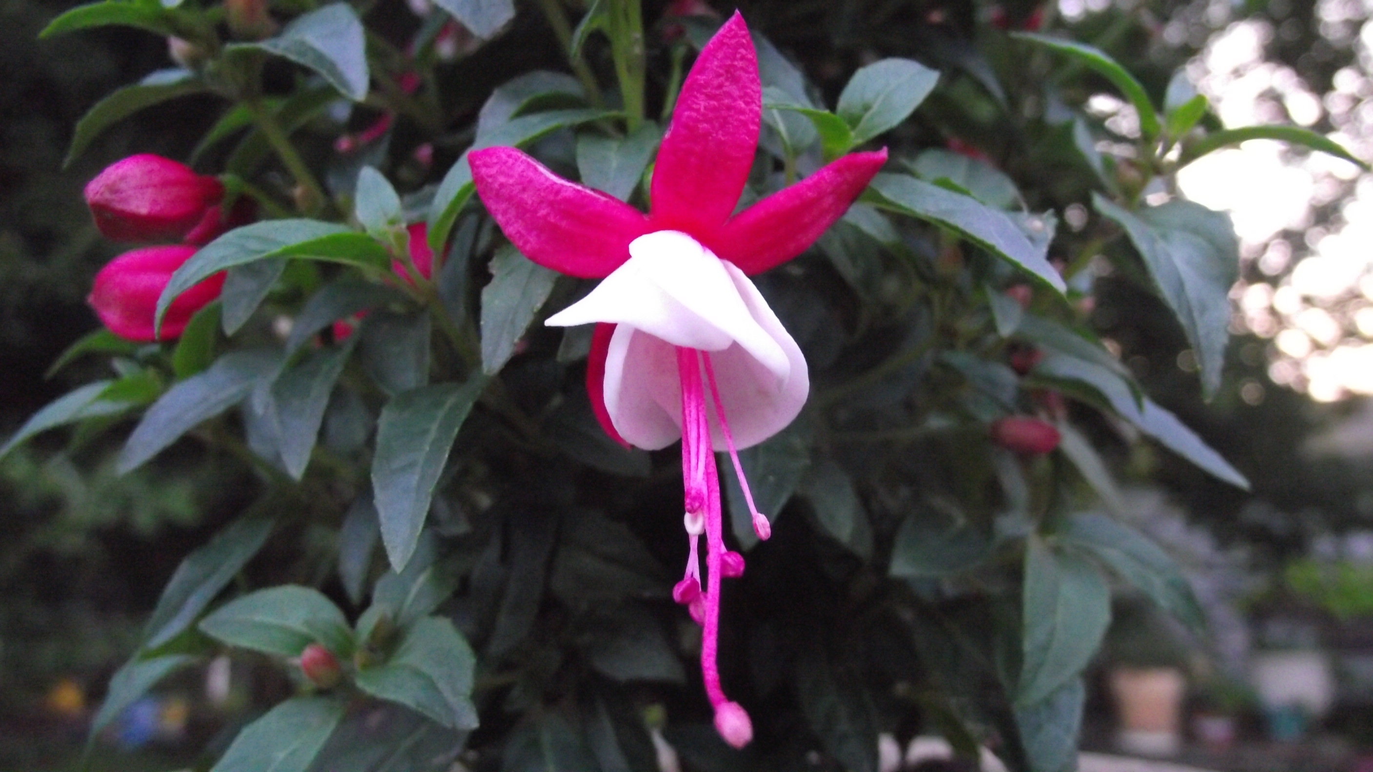
The more tender houseplants that are on the deck are now under the Manitoba maple where they will get protection from its canopy and should be OK. Brought in the fuchsia.
Closed the windows, I don’t think we need any fresh air tonight.
